


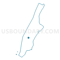
Voting District 7500069, New York County, New York
About
Outline

Summary
| Unique Area Identifier | 632591 |
| Name | Voting District 7500069 |
| County | New York County |
| State | New York |
| Area (square miles) | 0.13 |
| Land Area (square miles) | 0.13 |
| Water Area (square miles) | 0.00 |
| % of Land Area | 100.00 |
| % of Water Area | 0.00 |
| Latitude of the Internal Point | 40.75256890 |
| Longtitude of the Internal Point | -73.98551480 |
Maps

Graphs
Select a template below for downloading or customizing gragh for Voting District 7500069, New York County, New York


Neighbors
Neighoring Voting District (by Name) Neighboring Voting District on the Map
- Voting District 7300055, New York County, NY
- Voting District 7500012, New York County, NY
- Voting District 7500049, New York County, NY
- Voting District 7500062, New York County, NY
- Voting District 7500068, New York County, NY
- Voting District 7500070, New York County, NY
- Voting District 7500071, New York County, NY
- Voting District 7500080, New York County, NY
- Voting District 7500081, New York County, NY
- Voting District 7500083, New York County, NY
- Voting District 7500084, New York County, NY
- Voting District 7500086, New York County, NY
Top 10 Neighboring County Subdivision (by Population) Neighboring County Subdivision on the Map
Top 10 Neighboring Place (by Population) Neighboring Place on the Map
Top 10 Neighboring Unified School District (by Population) Neighboring Unified School District on the Map
Top 10 Neighboring State Legislative District Lower Chamber (by Population) Neighboring State Legislative District Lower Chamber on the Map
Top 10 Neighboring State Legislative District Upper Chamber (by Population) Neighboring State Legislative District Upper Chamber on the Map
Top 10 Neighboring 111th Congressional District (by Population) Neighboring 111th Congressional District on the Map
Top 10 Neighboring Census Tract (by Population) Neighboring Census Tract on the Map
- Census Tract 74, New York County, NY (4,319)
- Census Tract 82, New York County, NY (3,262)
- Census Tract 76, New York County, NY (2,277)
- Census Tract 84, New York County, NY (1,595)
- Census Tract 119, New York County, NY (1,120)
- Census Tract 109, New York County, NY (183)
- Census Tract 96, New York County, NY (155)
- Census Tract 113, New York County, NY (117)
- Census Tract 94, New York County, NY (73)
Top 10 Neighboring 5-Digit ZIP Code Tabulation Area (by Population) Neighboring 5-Digit ZIP Code Tabulation Area on the Map
- 10016, NY (54,183)
- 10036, NY (24,711)
- 10001, NY (21,102)
- 10017, NY (16,575)
- 10018, NY (5,229)
- 10110, NY (0)